Shoshone Lake Loop Ride
A Lander Classic: The Shoshone Lake Loop Ride
Shoshone NF, Southern Wind River Range
August 26th, 2007
Shoshone NF, Southern Wind River Range
August 26th, 2007

The Route:
 Click on the map to read it. The route is approx 40 plus miles, starting and ending from Lander. It requires a 5000 ft vertical climb, the last mile or so of which you have to push and hike. I left just before 9am and returned about 5pm. My elapsed ride time was 6 and 1/2 hours, while my actual time was closer to 8 hours. My usual fifty mile race time is between 5 and 6 hours. I'd say this ride qualifies as strenuous.
Hour One:
 Cranking up the pavement on Squaw Creek road, you can see the Shoshone Lake road switchbacks, just above the white house in the middle of the photo.
 After five miles of pavement you hop the dirt and ride through a guy's ranch on some public access roads. This stretch is often red and dusty and usually you're escorted by a few big white dogs.
 You're back on public land when you have drop into you granny gears and start the grunt up the switchbacks. For graded switchbacks, they're steep.
 After a few switchbacks, you're rewarded with some great views of Red Butte and Lander, down below. If the whole loop is too much for you, the switchbacks are definitley worthy. They make a good hour or two ride.
Hour Two:
 At the top of the switchbacks you'll see some FS signs and trailhead signs. This is where most folks park and unload their ATVs.
 From the parking area plan on climbing for about another hour- all of it is mostly ridable granny gear climbing. Fun stuff. It goes up forever.
 Did I mention it went up?
 Eventually you'll crest out on ridgeline, from here you get to go down a little, but not for long.
Hour Three:
 Once in the trees the road takes a sharp left and terrain gets technical.
 Very technical.
 Two miles of pure technical... hiking. Anybody that can clean this two mile section on a bike probably isn't human.
 It seems like this section goes on forever. I've covered it on an ATV before as well. It sucks even on an ATV. It's miles of bolders- rough as hell. Don't, for a minute, think that those folks on ATVs have it easier. A person can hike through this crap about as fast as reasonable person would drive over it. It took me an hour to cover this two mile section- hiking most of the way.
  Finally after an hour, the light at the end of the tunnel comes into view. You can ride again!
 You top out on Cyclone Pass.
 The view from Cyclone Pass makes the hike worth it. It's incredible!
 A cyclist on Cyclone Pass.
 A panoramic view from Cyclone Pass. Shoshsone Lake in the bottom. Wind River Peak is the dominant peak looker's left.
Hour Four:
 Looking down the road that drops Cyclone Pass into Shoshone Lake. I figured it couldn't be much worse than what I just hiked.
 I was wrong. The rocks were bigger.
  Since this was mostly down hill though, it was more ridable than it might appear.
Hour Five:
 It took me another 30 to 40 minutes to reach the Shoshone Lake from the top of the pass, but I eventually made it.
 The road skirting the edge of the lake was really quite pleasant.
 It wasn't all easy though.
 A little more hiking required.
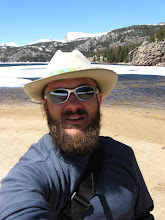
 The view from the south end of Shoshone Lake is rather park like.
  Just a ride in the park.
Hour Six:
 The road/ trail going up out of the south end of the lake. Too bad it all wasn't like this.
 The road parallels a pretty little creek for a while.
 Entering the south Shoshone Basin, a huge beautiful meadow.
 What a meadow! Gorgeous country!
 After the meadow, the road is pretty decent for a mile. It gets rougher- nothing that's not rideable though.
 Another meadow a little further down, near Twin Lakes.
Hour Seven:
 Once on the shore of Pete's Lake I knew I was gonna make it. I've done the up and back to Pete's Lake a million times. It was all down hill from here! I could smell the barn.
  Just before McMahone park, there's good view of the Middle Fork drainage.
 McMahone Park.
 The last nasty, narly section. It's tight on an ATV. I'd choose a bike any day for this section.
 With the tough stuff over, and Sinks Canyon in view, it was off the to the races! Down Fairfield Hill and then down the pavement all the back home. What a ride! It's a tough ride. If you do it, take lots of water and a means to get more, lots of food too. Leave early and plan on being out all day. I know a few other folks in Lander that have conquered this loop on a bike... not many though. It's an accomplishment if you can pull it off. Maybe I'll give it another whirl someday, after the pain subsides. Maybe next week. Ha!
 It's awesome to have country like this in your back yard. Gotta love it!
posted by Shad Hamilton at 7:56 PM
0 comments
![]()