Mount Sherman
Mount Sherman
Mosquito Range, Colorado
July 22nd, 2007
July 22nd, 2007
 14,036 foot Mount Sherman and the Mosquito Range
 Last year I noticed Mount Sherman during a 50 mile MTB race that I did in Leadville Colorado. We had so much fun last year in Leadville that we decided to stay a bit longer this time around. Sunday, the day after I did the 50 mile race, we decided it might be funny to take a stab at one of Colorado's 14ers. Though Mt. Sherman might not be the most famous one (ranks 45th amongst the 14ers in CO), it looked like it might be a good one to start with.
 Mandy leads the way. After a 20 minute drive up to a trail head at 12,000 feet, we left the truck and started hiking around 9am or so.
 Mandy stopped to smell the flowers, the columbine were in full force.
 Cruising through over the flats through the tundra, on the way to the approach.
 An hour into the hike, entering the gully between Mt. Sherman and Mt. Sheridan. Years ago, they apparently thought this was a good route for a telephone line. Amazing!
  Shad and Tally half way up the gully.
 Looking back down the gully towards Leadville.
 Hotrod Tinker races up the trail.
 Trails were paved with scree alot of the way.
 Finally we reached the saddle between Mt. Sherman and Mt. Sheridan. Now all we had to do was get on the ridge line and head for the peak of snow that's looker's right. That is the summit.
 Mandy scrambles up to the ridge line. She couldn't believe how easy it looked, summit fever kicked in!
 With the summit in view, the Mandy train was full steam ahead.
  Mandy clears ridge line and tears across the top to the summit.
 Mandy on the summit of Mt. Sherman, her first 14,000 foot peak... bagged.
 Tallulah strikes a pose on the summit.
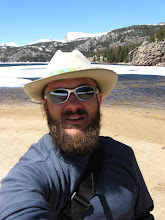
 I was up there too.
 A 180 degree panoramic view from the summit of Mt. Sherman, looking towards Leadville and beyond to Mt. Massive.
 A family portrait on the summit.

 More fun on the summit. It was nice enough, we ate lunch up there.
 Tallulah shared hers.
 Tally says, "It's all down hill from here mom, you can run it!"
 Mandy starts the jaunt down the hill, back to the truck.
 Mandy carefully examines the ridgeline before sprinting down it.
 Off to the races!
 Mandy approaches the next ridgeline full throttle. Weehooo!
 I chose a more casual pace. Took some time to look down some potential ski lines. Good stuff!
 Looking down towards our truck and the road we drove up on, which also happens to be a good part of the 50 mile MTB race course. Turquoise Lake and Leadville are way in the background.
 Back down where the grass grows and the flowers where in full force.
 With her summit fever cured, Mandy cruises through the wild flowers, back to the truck.
 The columbine were spectacular.
 Woohoo! We made it!
 Tally was ready to use her own legs again.
 A look back at Mt. Sherman.
 Mt. Sherman and the Mosquito Range.
  Tallulah slept well that night. We all did.
 That is... after she finally decided to go to sleep.
posted by Shad Hamilton at 12:45 PM
0 comments
![]()