Raft Lake/ Wykee Peak
FWCHS Wilderness Expedition
Washakie Park/ Raft Lake/ Wykee Peak/ St. Lawerance Basin
Wind River Indian Reservation Roadless Area, Southern Wind River Range
June 13th through the 19th, 2007

Washakie Park/ Raft Lake/ Wykee Peak/ St. Lawerance Basin
Wind River Indian Reservation Roadless Area, Southern Wind River Range
June 13th through the 19th, 2007

I did this trip as a principal for a class I organized for students attending our high school at Fort Washakie (FWCHS). I worked with the National Outdoor Leadership School (NOLS) to put together a wilderness experience for our students that would get them in their own wilderness. The Wind River Reservation Roadless Area is basically quite a chunk of Southern Wind River wilderness that doesn't see many people. It's pristine wilderness. To be able to explore it with students whom some day could manage it, was extraordinary.
The Route:
 (click to enlarge)


Left to right; Matt Lloyd (aka "Old Lady"), General Iris Saxer, and ex- felon Rachel Landis (aka "The Choker")

Day One:
 A peek through the trees minutes after starting down the trail from Washakie Park.
 Cruising through some open country on our way to our first "x". We didn't make too far the first day because we didn't really make it to the trailhead until after 3pm.
 Approaching our first night's camp site.
 The view from camp; Shoshone Mountain. It was a great place to spend the night. We saw some Elk and maybe a Wolf in this meadow (could've been a coyote on steroids).
 The view looking down on Yahtic Lake from the other side of the ridge we were camped on.
Day Two:
 A look at Twin Lakes and some of the country we'd have bushwack, I mean hike, through to get to Raft Lake. Wolverine Peak dominates the sky line looker's left.
 After a few hours we reached Twin Lakes.
 Amazingly enough, there was a bridge still entact between the lakes. That made crossing the lakes pretty easy.
 After crossing the bridge, we went off-trail a bit and followed the drainage up to Raft Lake.
 Our route got pretty interesting the closer we got to Raft Lake.
 Treking poles don't help much traversing granite cliffs.
 After traversing and climbing some small cliffs, we dropped into a tight canyon that lead up to Raft Lake.
 Eventually the canyon spit us out on top, where we got a great view of Raft Lake. We set up our second camp just a bit further.
Day Three:
 The next morning looking up the Raft Lake drainage. We had great view of Wykee Peak from our campsite, so the group decided it would be fun to climb it. With that in mind we made our way up past Raft Lake, to Movo Lake in order to position ourselves for an ascent of Wykee Peak the next day.
 Who say's Wyoming doesn't have beaches? Surfing might be a tad bit cold- no sharks though. Ha!
 Raft Lake from Raft Lake beach. Wykee Peak is far looker's left. That would be our objective the obejective for tomorrow.
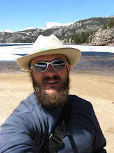
 Some dude on the beach.
 Later we found another good bridge across Wolf Creek. The trail got pretty good after we crossed the beach. It seemed like that it probably saw most of the traffic into this drainage.
 Looking up, and then down Wolf Creek. Good thing there was a bridge.
 There weren't bridges everywhere though. Matt watches as students cross a small flooded lake and meadow.
 Crossing the flooded lake with Wykee peak in the background.
Day Four (Wykee Peak Acsent):
 Heading up a snow field on our way to the top of Wykee Peak.
The original plan was to get up at 6am and start hiking at 7am. Our commanders awoke to the sound of rain and thunder at 6:00am and decided beauty sleep was a better option. Later by 8am or so, the clouds started clearing and it looked like the weather would clear. We left to conquer Wykee Peak around 10am- knowing that the time we had before the next storm started building was probably going to be very limited.
 A student kicks in a boot track up the snow field for the rest of the crew.
 Lots of stuff like this before we reached the ridge line that would take us to the summit of Wykee Peak.
 Pausing for a view before the ridgeline.
 Refeuling and gathering strength for the final climb to the ridge line. Wolverine Peak looker's left.
 The final push, just to the ridge line below Wykee Peak.
 Finally once on the ridge, Wykee Peak (12,055 feet) comes into full view.
 A look up the Little Wind River drainage from the saddle below Wykee Peak.
 Making the final climb towards the summit of Wykee Peak, racing clouds that seemed to be building. Unfortunately a few hundred feet shy of the summit, after hearing thunder, we had to abort. Denied, we turned and headed for lower ground.
 Scrambling down Wykee Peak towards the saddle, trying to beat the weather.
 A variety of down-hiking/ scrambling techniques were employed.
 A look at Mt. Baldy and the Twenty Lakes drainage from the saddle below Wykee Peak.
 Beautiful country!
 Good stuff!
 Our route back down to camp seemed to afford a few more opportunities to play in the snow.
 Weehoooo!
 I demonstrated proper self-arrest technique to avoid going for a swim in the hefty puddle at the end of this drift. Glad someone was able to document it. Ha!
 One last look up the Little Wind River Drainage, before descending to camp. Truly amazing country. I was thrilled that our students were able to experience some of it at 12,ooo feet.
Day Five:
 We began our fifth day with a nice nads-deep morning wade across the balmy Little Wind River. Our goal was to intersect the Kagevah Pass trail and follow it out to St. Lawerance Basin.
 A look at some glaciers up the Little Wind drainage, from somewheres along our bushwack to the Kagevah pass trail.
 A look towards Windy Ridge from across some lakes that we camped near.
Day Six:
 A different look at Wykee Peak from one of the meadows we hiked through on our way up the pass that would lead down to St. Lawerance Basin.
 A look back at the Wilson Creek Drainage and Look Out Mountain from the pass.
 The pass we hiked over (up inbetween the snow fields).
 The Meadows, a few mile above the St. Lawerance trailhead. What a way to finish a great trip! You could see our whole route from this meadow. We spent our last night a little ways below The Meadows and got picked up at the St. Lawerance Guard Station bright and early the following morning.
A special thanks to the Eastern Shoshone and Nothern Arapahoe Business Coucil for permitting NOLS to conduct this course for our students on the Wind River Indian Reservation.
 "I want for my home the valley of the Wind River and lands on its tributaries as far east as the Popo Agie and want the privilege of going over the mountains to hunt where I please."
- Washakie, 1868
posted by Shad Hamilton at 11:49 PM
0 comments
![]()