Sunday, April 23, 2006

Jules Castle Couloir

Jules Castle Coulior
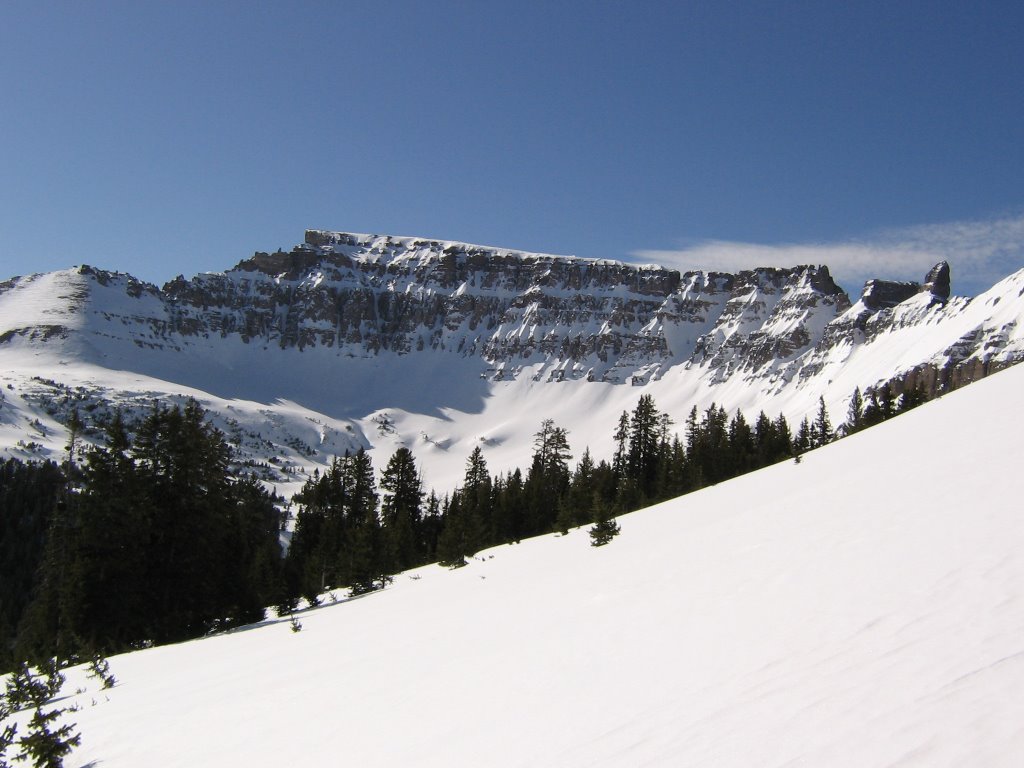
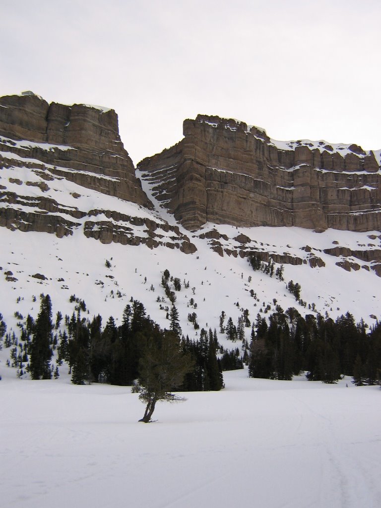
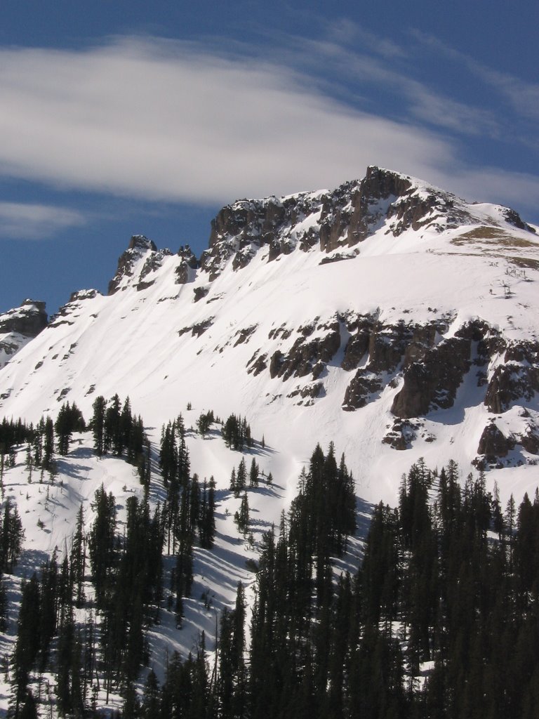
Jules Bowl, Brooks Lake Area, Shoshone NF, Absaroka Range

April 22nd, 2006

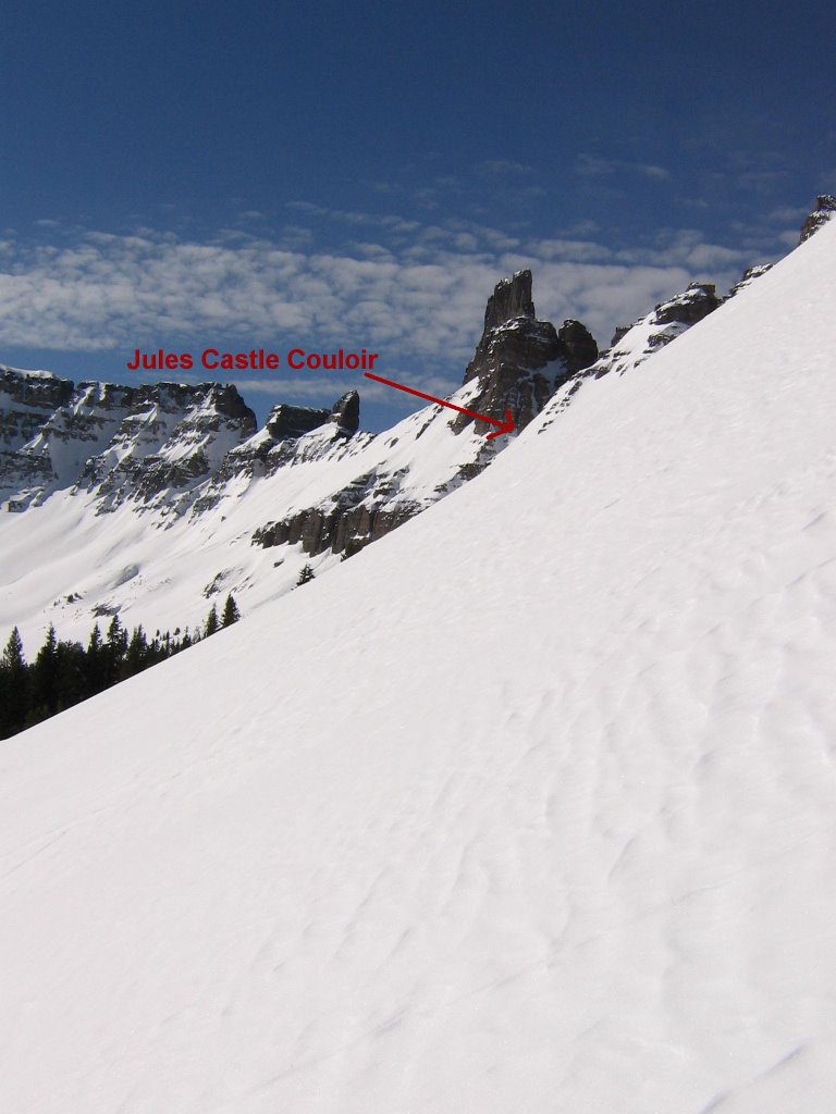
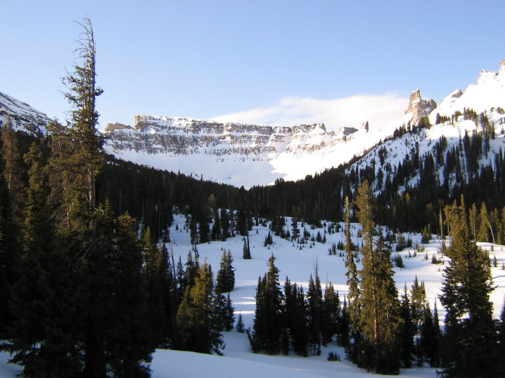
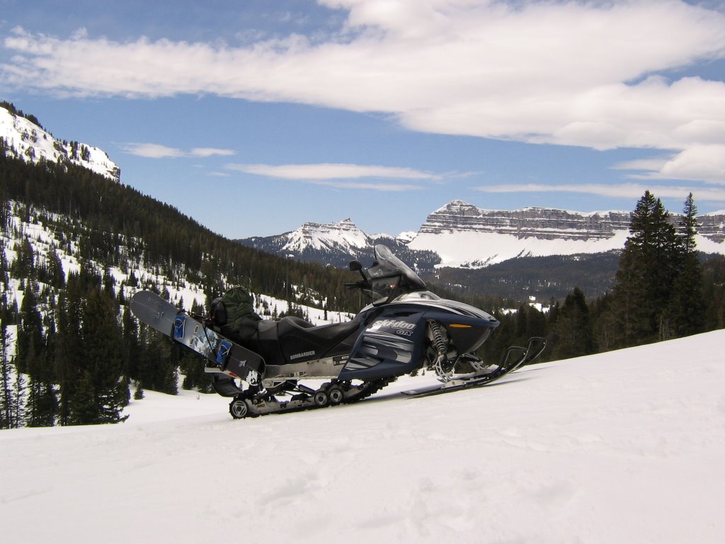
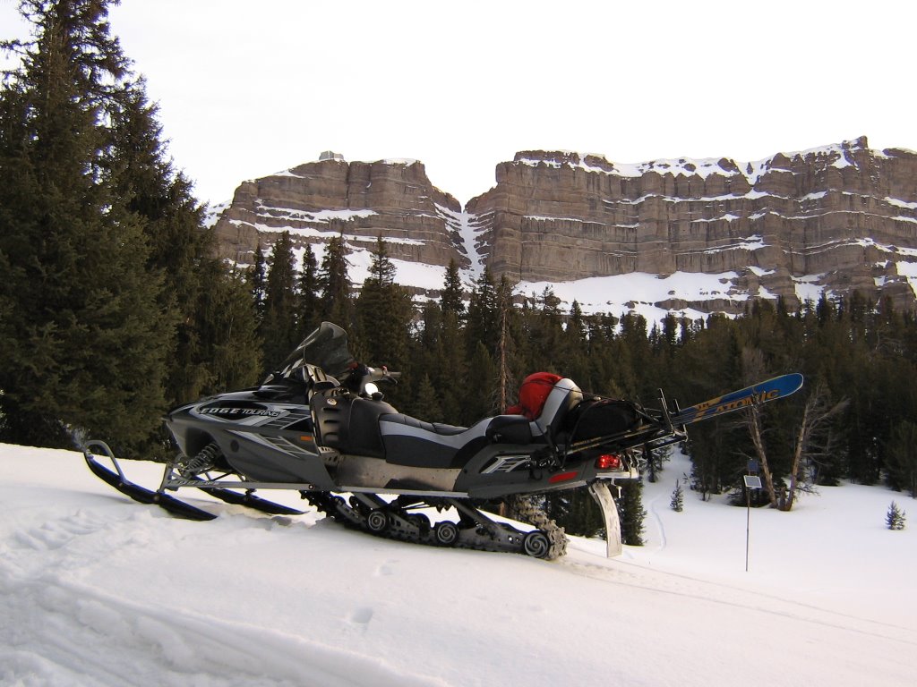
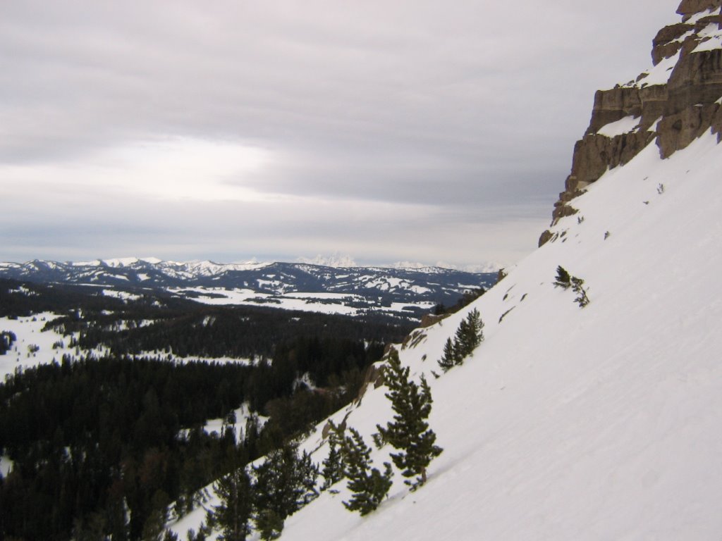
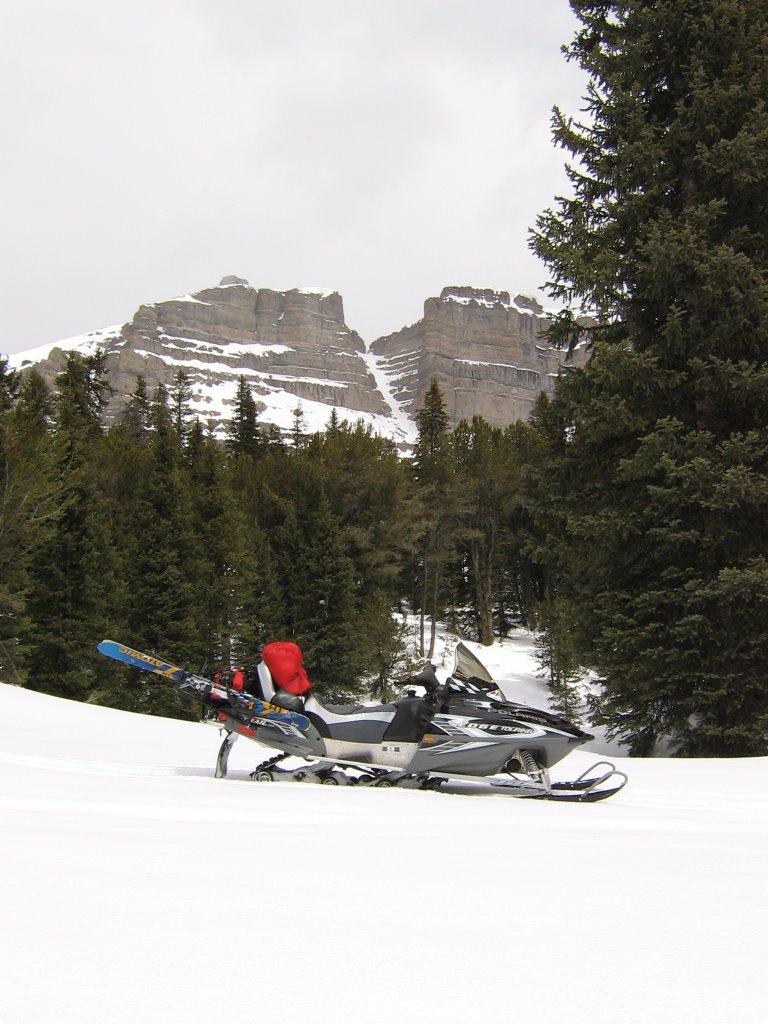
Me and the Skidoo on the way into Jules Bowl to find a couloir. Jules Castle Couloir is in the background. I'm guessing the "Castle" is on the left.


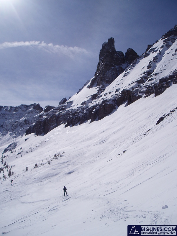
Around the first part of March this year some dudes I know went into Jules Bowl and busted some lines down this couloir. They had a snow machine, but I think they were mostly out for a hike that day. Sure looks like they got a good one in too. Beautiful country, lots to look at while skinning!


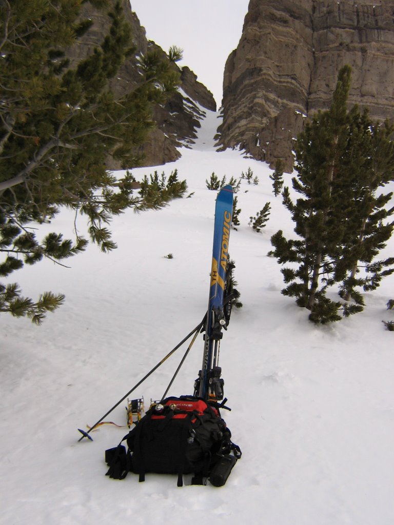
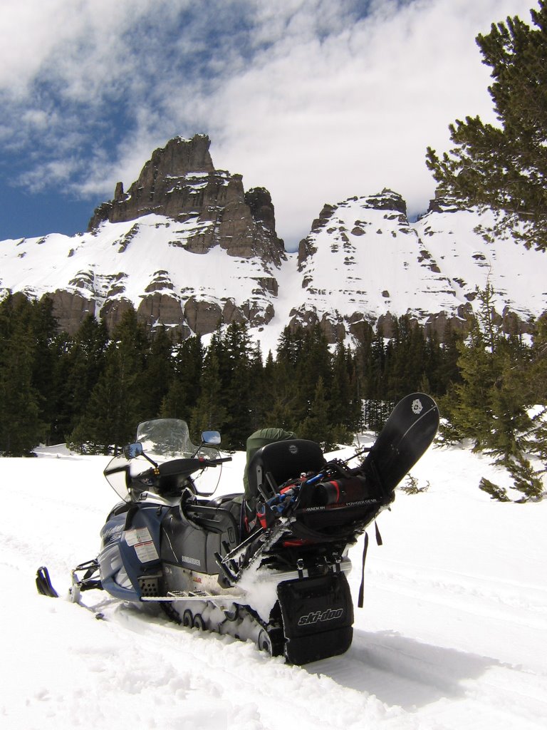
Here's where I started my hike from.

Not counting the 10 mile, 20-30 minute drive in and the five other runs I did in the area before I motored up into the bowl, it really took me less than an hour to climb this couloir and drop it. It's not a monster, but it's WAY fun... especially on a splitboard!


Starting up the JC couloir.


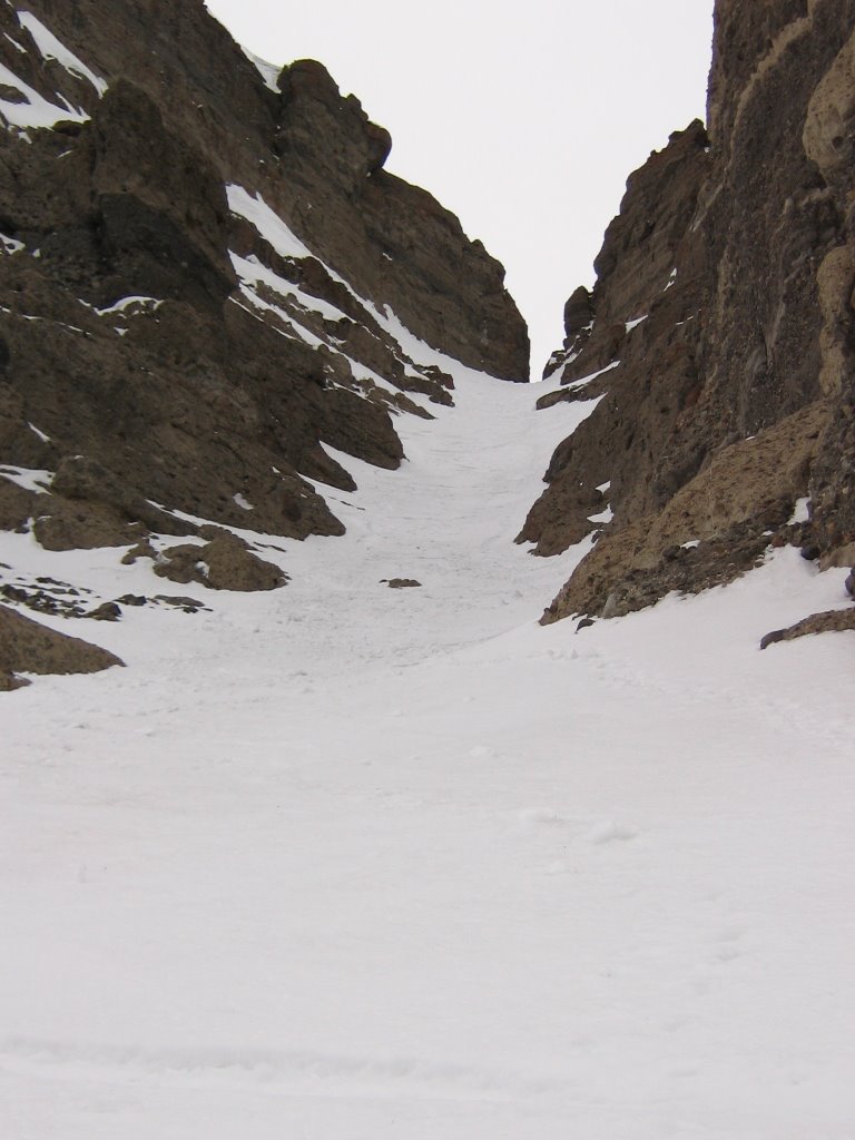
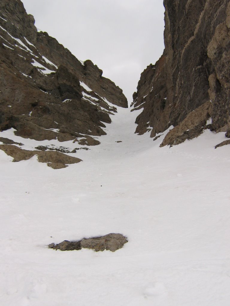
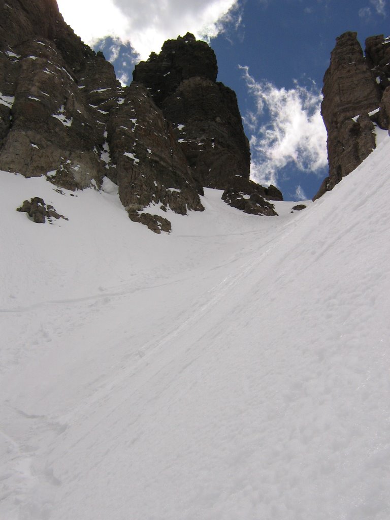
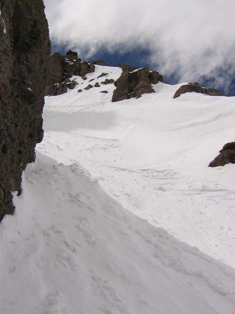
Looking down the coulior from about a third of the way up.


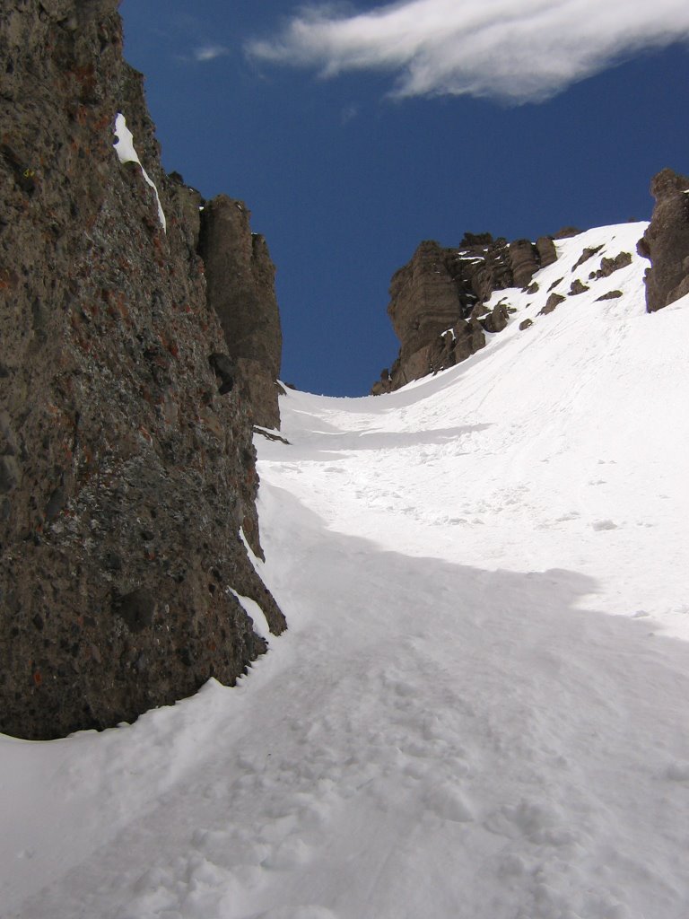
Getting closer to the top.


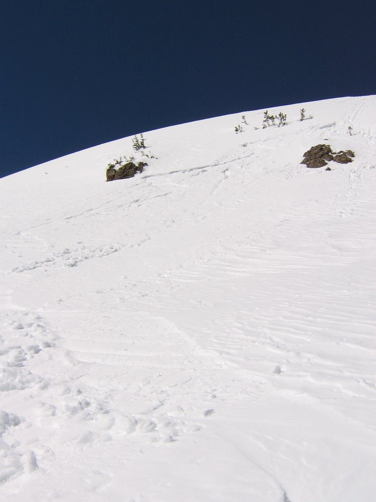
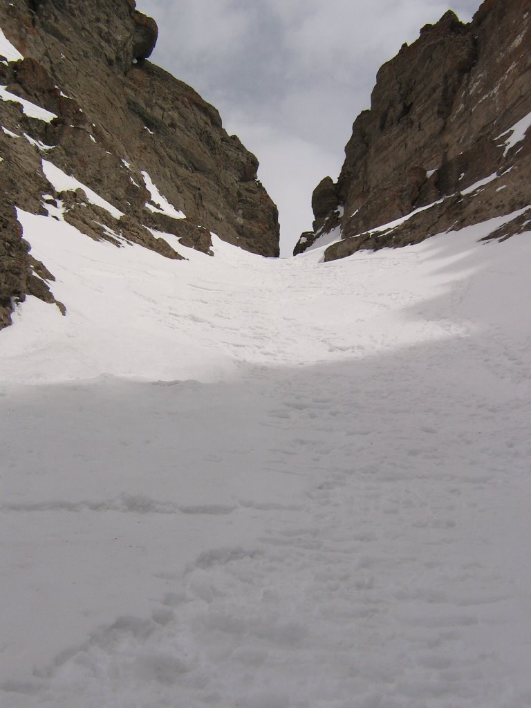
Almost to the "gap" or "notch". High tech couloir terminology. Ha!


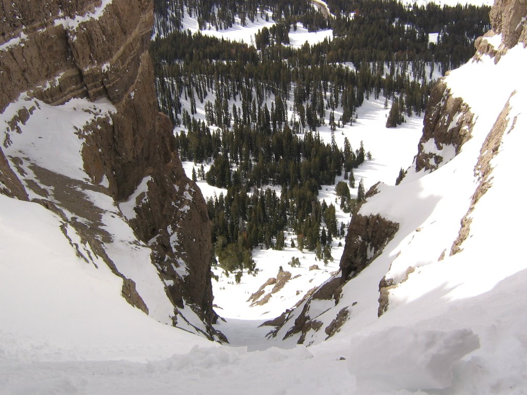
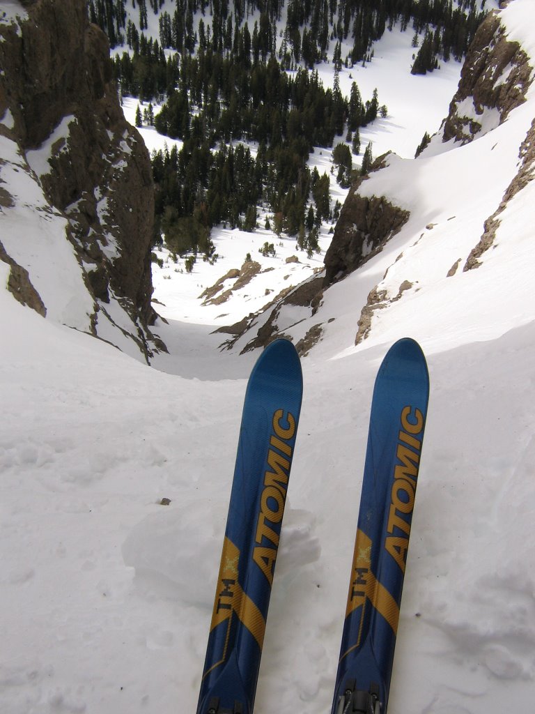
Approaching the top, and looking down on my boot track from about the same spot.


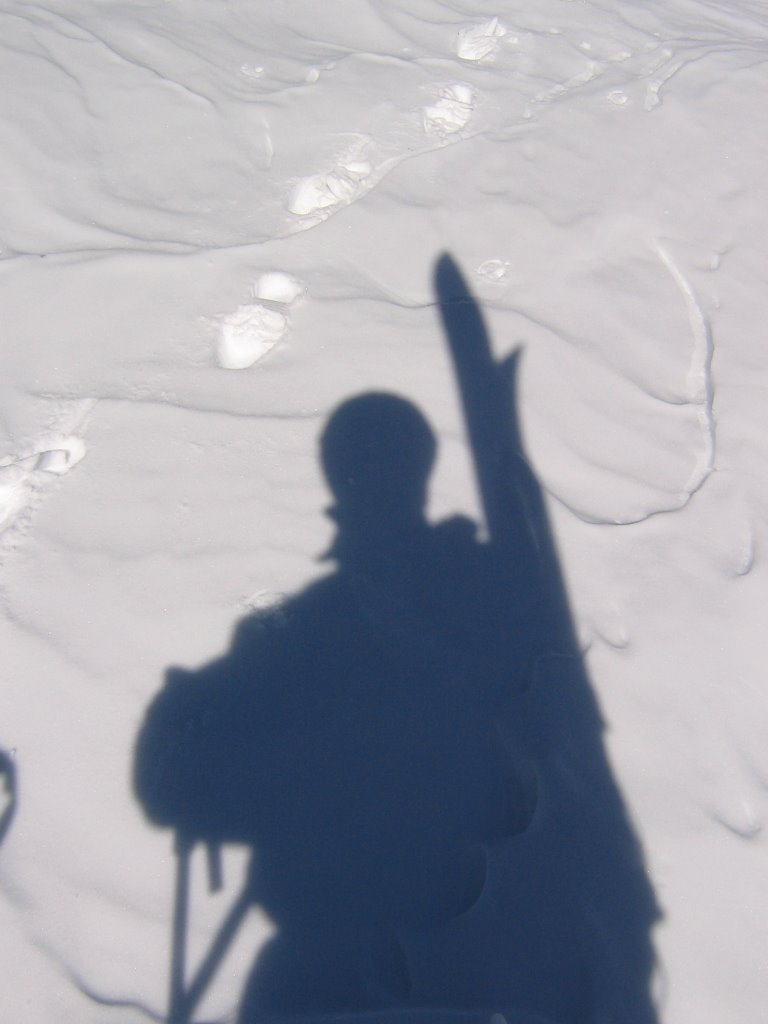
Flying solo again today.


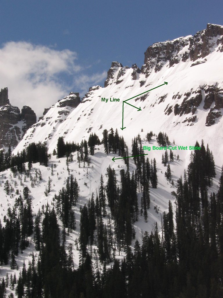
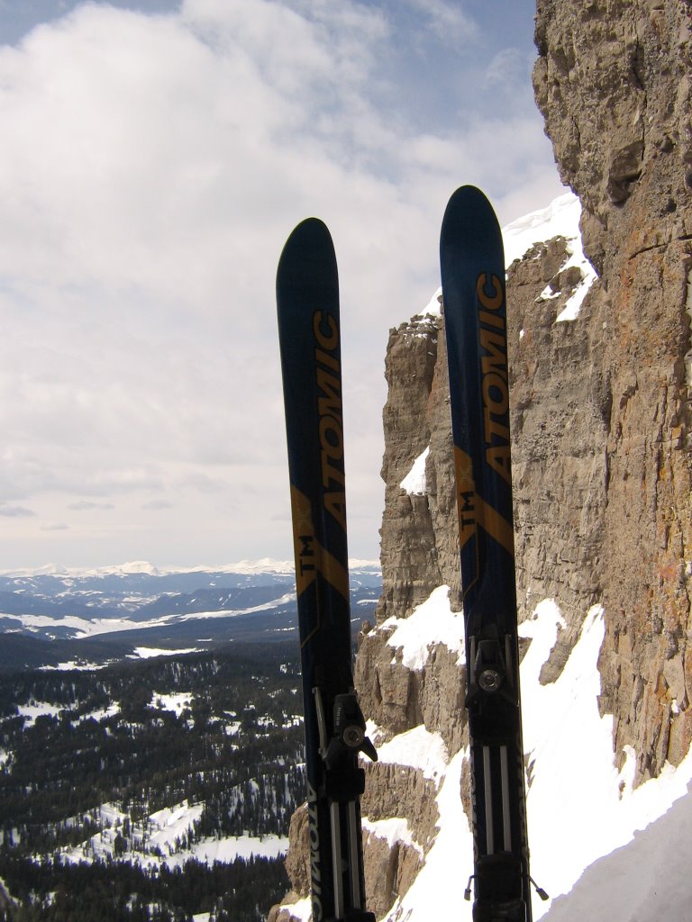
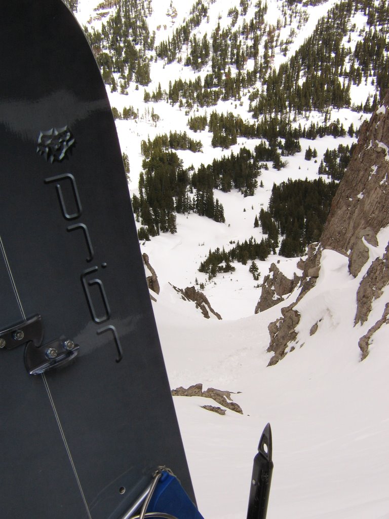
View from the top, looking down another couloir that drops down the other side (left) and looking down the coulior I just hiked up (right). You might be able to climb the left one, but you'd sure need some skinny skis to drop it. It's plenty steep too. Not much room for a parachute. Ha!


Bombs away!

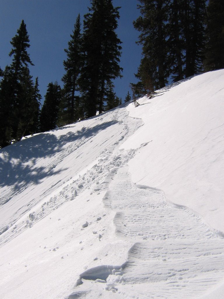
Almost literally today, there was alot of sluff rippin' loose. It was nice not having to drop ice, but the heavy sluff made it hard to clobber consecutive turns in the gut. Mostly I had to drop to safe spots and wait for the sluff to pass, then drop to the next one. Still fun though!


Lines and tracks that didn't get sweeped by sluff.
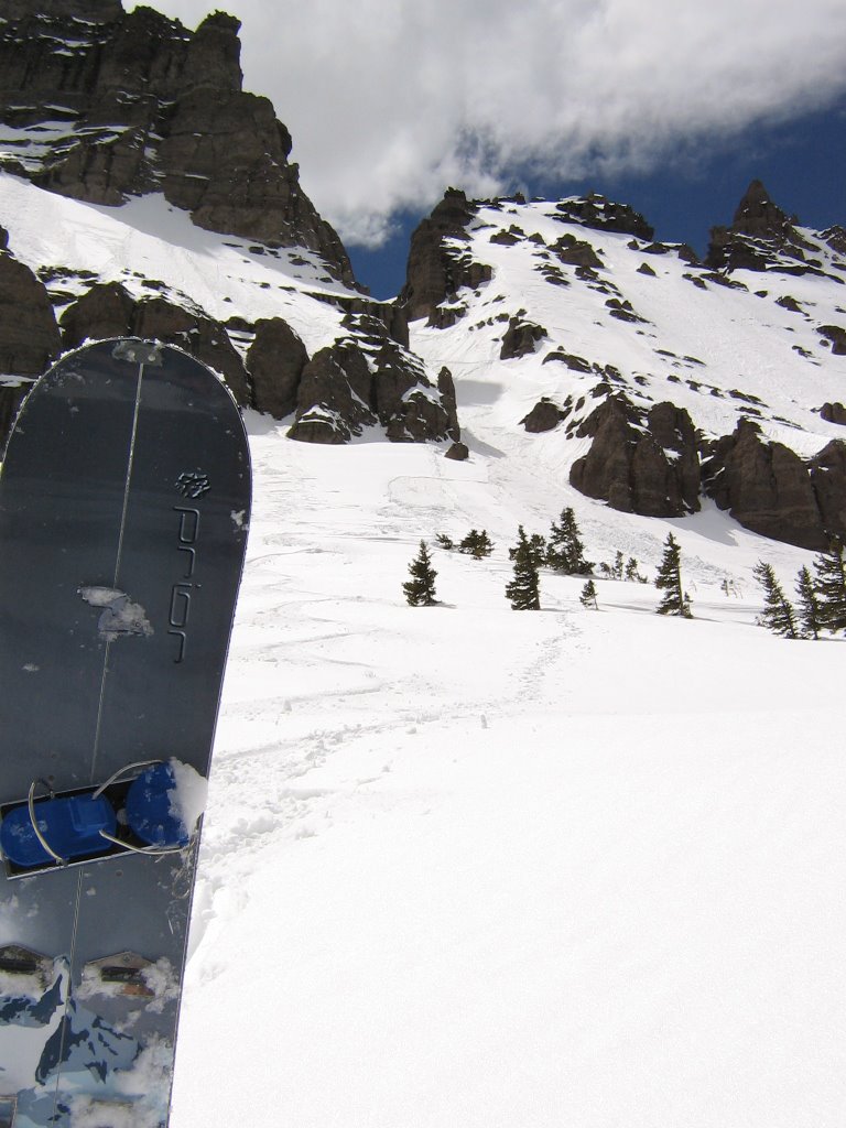
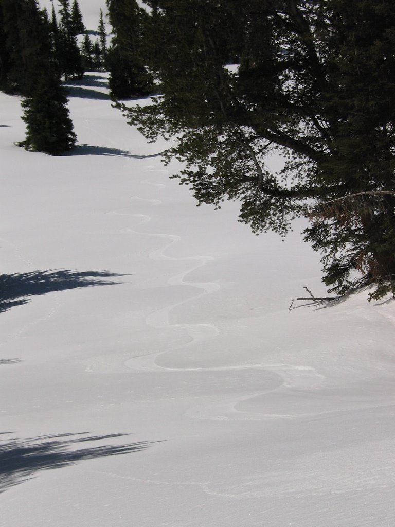


All done!

Once out of the coulior and away from the sluff drainages, turn were candy. Yummy!


Looks like someone was playing in the moat.


Gotta give the Skidoo some credit. As easy as this access is, I forsee some 3 to 5 couloir days in this area next year. Not sure if conditions will allow many more trips this year.


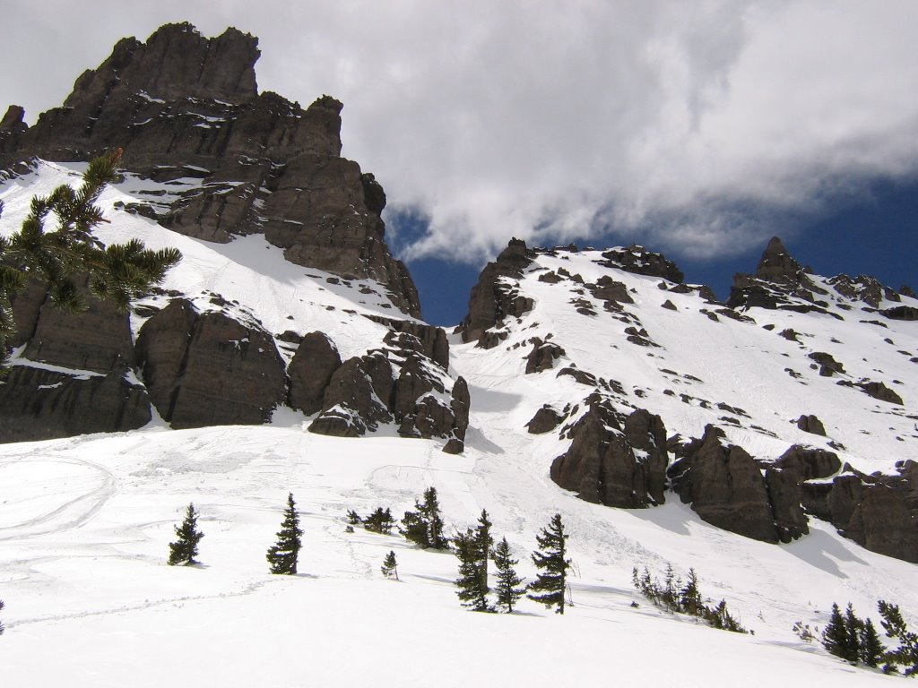
One last look back at the JC couloir on my way out. What a great way to wrap up the snomosking season in the Absarokas!


Don't have a Skidoo? Maybe try dogsled. Or better yet...


Catsled


"Yahoo!" Tally coos. "Meouushhh! Meouushhh! Go cat go!"


2006 1000 kc Artic Cat Radio Flyer

The engine really purrs!

Jules Bowl/ Bonneville Pass Area

Jules Bowl/ Bonneville Pass Area
Brooks Lake Area, Shoshone NF, Absaroka Range

April 22nd, 2006

Jules Bowl


Really very outstanding country! This is a popular area for snowmobile high marking, but since they quit grooming trails three weeks ago it hasn't seen much traffic. However, three guys did show up later this day and punch a trail in there. Which was handy for me. I was able to follow their trail in and motor up to a couloir to wrap up my day.


Before I did made my run into the JC Couloir I tackled a line on this hill. I was hoping to scope out the GD Coulior we dropped back in November. It's out of the picture to right.


A profile of Jules Castle, from up high, on my climb up.


Up on top, a terrific view of Bonneville Pass. And I thought I was getting up pretty high just hiking over Bonnevill Pass (10,000ft.) . I must have been over around 11,000 ft. when I took this photo, and I was just on a bench- not even peaked out.


Tracks down from my upper most perch.

After climbing up the bench, I went over to the GD coulior and looked it over. I decided not to drop it because it was surrounded by hefty cornices, and it was heating up pretty good. So I went back to where I climbed up and down climbed a bit. 55 plus degrees is too steep for me on a snowboard, by myself. Once I got in the 45 neighborhood, I was good. The snow was great, almost too great!


Once in the trees I cut a line across the top of a 40 degree slide path. It ripped. Pretty good little wet slide. I wouldn't have wanted to be in it.


Click on this photo and you can see my board-cut and the slide path. Needless to say, after that, I took a safer route on a ridge line down through the trees.


Jules Bowl from aways up the Bonneville Pass Trail.


After triggering some nifty wet slides I decided to find some colder snow. I motored up the Bonneville Pass trail a bit, until a found these wide-open low angle runs. Sometimes it's just fun to play around.


Beautiful line!


Turns galore!


Skidoo brand chairlift with the Brooks Lake Butte and Pinnacles in the background.


Back at home...

Tally was getting some rides in too.


Finally, a good use for Fat Cat.

Saturday, April 15, 2006

Sublette Mountain Couloir: Part 1 South Side

North and South Sublette Mountain Couloirs

Shoshone NF, Absaroka Range, Continental Divide/ Togwotee Pass Area

April, 14th 2006

The South Sublette Mountain Couloir (also called the "Radio Tower Couloir")


I decided to exercise the Polaris a bit. Didn't have to, as this couloir is not far off of the highway. It fun though, plus it scares all the grizzlies away!

SSMC, on approach- was skinning by now, but there were sled tracks I could have followed to the base of it. A guys got get a little exercise though.


Had to stop and put on my cramp-ons. I left way early, it only about 7:00am when I reached this point. With the light clouds, the snow wasn't cooking fast, it was ice hard. Some snowboarders beat me to this couloir. I followed their track in. I did appreciate the boot track they left me going up the couloir. By their tracks it looked like they had much better (little warmer) snow conditions than I did. They missed out on the north side run though.


Some dumb-arse dude climbing and skiing couliors by himself.


Two Ocean Mountain, as from the bottom part of the Couloir.


Looking out at Tetons from the bottom part of the couloir.


In the couloir, towards the top, looking up.


In the couloir about a third of the way up, looking up.


Almost there. Nearing the top of the South Sublette Mt. Couloir.


My skis perched on top of the Coulior in the gap/ saddle area. There's a gap/ saddle in the rock at the top of the couloir. I quickly learned that on the other side of this gap was another couloir. It wasn't as defined, but it was more filled, and the snow looked much tastier. Have a look at part 2 and speck it out.


The view looking down the South Sublette Mt. Couloir. Forgot my parachute. Oh well! Actually I didn't get out my inclometer on this run, but I did when I dug a pit on the other side. My pit was a on 50 degree slope. The first third of this coulior was definitely steeper (somewheres around 55 or 60). Guess I should have measured. Didn't want to look down though- ha!


Bombs away!

Whahoooo!!!

Tallulah May dropin' crib lines!


I reached the top at 9:00am. Despite dropping the North Side Couloir first, climbing back up it and then eating lunch, when I finally mustered courage to drop (around 11:30am)- it was still icey and crusty. Not even good scralping conditions. The old snowboard tracks made it all very inconsistent too. Since I was solo, I played it safe and side stepped/ skiied about a third of the way down.


Check out those lines! Ha! Not exactly turns though. The skiing towards the bottom got better, delicious in fact. It had cooked up enough to provide some tasty corn.


Five hours and two couloirs later, back at the hot rod, taking one last look back the crack I dropped.

Sublette Mountain Couloir: Part 2 North Side

Part 2:

The North Side Sublette Mountain Couloir

Like I mentioned in the prior posting, after I climbed the south facing couloir, I discovered another coulior up an over the gap. No one had dropped it yet, and the snow looked great.


Looking down the North Sublette Mt Couloir.

The sun came out after I dropped this, so most of the pics were taken after I had skiied and climbed back up it. I'm not even sure the snowboarders who dropped the south side new this was there. Judging by their tracks and piss puddles, they never even bothered to climb up through the gap to see what was on the other side. No bear instincts I guess.


This run definitely called for a pit before committing. My shear test got some Q1s, but the only one that would come out in a tap test was 20 cm deep (surface)- the rest was solid. I tossed some heavy blocks of snow out on the slope. Nothing. Looked like it was a go, though I made a couple of ski cuts to safe spots just in case. Then I went to work on pasting squiggles.


Hiking back up, after laying down a pretty fun line.


Looking down the North Sublette Couloir, perched and ready to pounce, the atomics take credit.


The gap/ saddle or notch between the north and south couliors.


The view up the north couloir, about a third of the way up.


Looking down on my lines and tracks as I climb back up the couloir.


A profile view, coming out of the couloir about two third of the way down.


Tally pretty excited about getting strapped into a snowboard for her first ride! Don't worry mom, we didn't leave the crib.


Looking up the couloir, to the notch, as I make the climb back up.


Finally, back on top, my skis, gear and I getty ready to have some lunch. The North Sublette Mountain Couloir turned out to be much, much better skiing than the south side. Oh well, it all goes down- and it looks really cool! Ha!


View of Ramshorn and Amoretti from Horse Creek

Sunday, April 09, 2006

Three Coulior Day in the Winds: Part 3, Chuck's Coulior

Part 3:

Calvert Lake Couliors

Southern Wind River Range, Silas Canyon, Popo Agie Wilderness Area, Shoshone NF
April 8th, 2006


Chuck's Coulior


This time Chuck begins the stomp up his coulior.

He didn't know it was his at the time. None of these couliors have names that I know of. It's also pretty safe to say that they've never been skied or boarded by anyone before. I needed some way to tell them apart and describe them. I figured, three of us, three couliors, that'll work for me. Ha!


Karla starting up her third coulior for the day.


Chuck getting close to the bottleneck on his coulior. From this point on we'll go from safe spot to safe spot, one at time. There's a hefty cornice aimed right at the neck of this puppy, and I saw evidence of a good wet slide in this coulior a month ago. I'm not too worried about the cornice dropping this time, because the snow is not hot enough, and it is only getting cooler now.


As we negotiate the neck and narrows, we hug the right wall and move from safe spot to safe spot- or as safe as we think it might get. You can see the cornice we're worried about up the head of coulior.


Once out of the narrow neck, it opened up and we were once again able to get out of the main slide path should the cornice decide to go. It got steep though. Chuck makes his way up my boot track, probably wishing he had an ice axe.


Looking down Chuck's Coulior as Chuck makes the final climb up between two cornices.


Shad on top of Chuck's coulior. Something not too many can claim, I would imagine. Ha!


Chuck rest and enjoys the view from the top of his coulior.


Time to ride! The snow got colder while we climbed. It was more scralping than we thought it would be riding Chuck's coulior. Still fun though. If you look behind Chuck, you can see the drifted spot where we were able to climb up between the corniced ridged. Turns out the cornices were really solid. Better safe that sorry though.


Chuck puckers up...


and drops his crack like a pro!!


Chuck's coulior, after we were done with it.


The "atomic" line down Chuck's Coulior.


Chuck hugged the left in the shade where the powder was better. I opted for scralping the gut. Did a flip turn or two as well too, but hey- it looks cool! Ha!


This pretty much sums the whole day up.


From a distance you get a good idea how big and how steep our lines for the day really were. By the time we made it back to the snow-machines around 5:30pm, Chuck's gadget said we had boot hiked, skied and skinned almost seven miles and had gained over seven thousand feet in elevation for the day.

What a way to wrap up another winter season in the Southern Wind Rivers. I might make it out a few more times before I have to put the sleds up and get out the hiking boots, but I doubt I'll be having any more three coulior days for a while.


What Shad does alot of after a three coulior day.


Three Coulior Day in the Winds: Part 2, Shad's Coulior

Part 2:

Calvert Lake Couliors

Southern Wind River Range, Silas Canyon, Popo Agie Wilderness Area, Shoshone NF
April 8th, 2006


Shad's Coulior


After descending Karla's Coulior, and getting out of the snow blasting wind, we got a look at some more couliors. Since it wasn't really even lunch time yet, we didn't feel right about leaving. So... we pick another one and headed up. Chuck leads the way of Shad's coulior.


Chuck marches foward, stomping in one fine boot track I might add!


Looking down the boot track at Karla, as she racks up some more vertical.


Chuck got tired of paving the road the whole time. Shad takes a turn. What's those thingers on his back?


Chuck makes his way to the summit of Shad's coulior.


Chuck on top!


Shad on top of his coulior. Silas Canyon in the background.


Tallulah gets to snooze in the snow for the first time. Dreaming of couliors to come, no doubt!


Looking down the gut of Shad's Coulior.


Bomb away! Shad let's it rip! Are those poles?


Yahooo!


Not bad! Soft sun crust, but very skiable!


Shad at the base of his decorated coulior.


One last look at Shad's Coulior.

Hmmm, only 1:15pm now. Wouldn't be right if Chuck didn't get a coulior too. We'd better get up another one before we call it a day. Wouldn't want to settle for just two couliors! Ha!

(See Part 3)

Three Coulior Day in the Winds: Part 1, Karla's Coulior

Calvert Lake Couliors
Southern Wind River Range, Silas Canyon, Popo Agie Wilderness Area, Shoshone NF
April 8th, 2006

Karla's Coulior


We met at the Louis Lake Parking lot at 6:30am. To ski the Calvert Lakes area you have a 15 mile snow machine ride to the wilderness boundary. Then a 3 mile skin up Silas Canyon just to get in the area. It's worth it though. I got the Atlantic Peaks mixed up in this picture, but you'll figure it out.


Here's the view about a mile or so into Silas Canyon. The Calvert Lakes kind of another separate canyon or drainage that is in between Atlantic and Silas canyons.


This is Christina Lake viewed from the saddle or ridge that separates the Calvert Lake drainage from Silas Canyon.


Here's the first peek you get of the Calvert Lake couliors when you climb the saddle. For Karla's Coulior, we used this ridge to access the top of the aspect.


Chuck begins the boot pack up to the top. It was really windy up there (60mph gusts). Karla had a hard time standing up- we all did. Strange snow though, because it was warm. The snow would stick to you, then melt and turn to ice.


Karla pushes up the final pitch to the top. Even though it was windy, the snow was soft. Not too soft though, it felt great! The boot tracks would set up really good.


Since it was so windy and miserable up top, we looked for the first coulior we could find, so we could drop and get out of the wind. This was my first look down Karla's coulior. Had visibility been better, I'm not sure I would have picked this one to do first. It was pretty steep and narrow up top. I down climbed it a bit to check snow conditions and make sure it went where I thought it did. It was safe, it would have to do.


We down climbed the coulior a bit to get out of the wind. We dug a ledge to hang out on while we got ready to drop. I did some more snow tests. Very good snow pack. Conditions were a go. If you look close you can see the frozen hair hanging out of Karla hood. I'm not sure, but I kinda think maybe I might not have been her favorite person at this point in time. Ha!


Chuck and Karla begin to drop Karla's Coulior.


Chuck and Karla out of the narrows and on to the apron!


Chuck, wiggling his way down through a gap.


With the gap behind him, Chuck lets tears it up!


Go Chuck!


Karla finesses her way through the gap and surfs her coulior.


When we reached the bottom, the smoke cleared and we could see what we just dropped. Yowza! Looks like we could have probably taken an easier line. Oh well. We're "hard core"! Ha!


One last look at Karla's Coulior.

"What now?" It wasn't even lunch time yet. "Hmmm, that one looks good . Let's try it!"

(See Part 2)

Monday, April 03, 2006

Atlantic Peak Expedition Part II: West Atlantic Peak

PART 2: West Atlantic Peak

Splitboards Get First Descents on Atlantic and West Atlantic Peaks


Shoshone NF, Southern Wind River Range, Popo Agie Wilderness, Christina Lake Area

April 2nd, 2006

This is West Atlantic Peak, approximately 12,500 feet, as seen from the top of Atlantic Peak. It was obviously higher than the one we were standing on, so despite the bone-yard that separated us from it, we had to try it.


Chuck negotiates the bone-yard.


After the bone-yard, we get a few drifts to hike on. That's Christina lake in the background below, and half of Wyoming.


Boards on again, Chuck and Karla make it onto the base of the West Atlantic Peak slope and begin the climb.


Me (Shad) on the summit of West Atlantic Peak, my splitboard peeking out behind me.


Back at home Tally does some technical reading, preparing for the day.


Chuck and Karla on the summit of West Atlantic Peak. Windriver and Temple Peak in the background.


Shad, eyes a couliour off the top of West Atlantic peak. Very tempting. Hard to say what was around the corner though, plus I had my share of climbing already for day and that was the only way back.


A view and a couliour from the top of W. Atlantic.


Looking out towards the Wyoming Range from W. Atlantic.


Yet another view from the top. Windriver peak is central, Temple is to the left and Lizard Head peeks out to the right behind Windriver. Beautiful country.


Three splitboards at 12,500 feet. Cool.


Chuck and Karla getting boards ready to ride.


Chuck rides the waves...


And surfs the white-caps on West Atlantic Peak!


Karla scralps it up!


West Atlantic Peak, dressed in it's first splitboard lines. Not exactly powder, excellent scralping though! We dropped the first knob then un-hooked to hop over to the main, facing aspect. Who could complain about scralping, with the weather we were getting. Warm, no wind. Unbelievable!!

Atlantic Peak Expedition Part I

Splitboards Get First Descents on Atlantic and West Atlantic Peaks

Shoshone NF, Southern Wind River Range, Popo Agie Wilderness, Christina Lake Area

April 2nd, 2006

We got up a bit earlier for this expedition. The objective being; climb Atlantic Peak and maybe West Atlantic too. Yes, these peaks already have names- ha! They have been climbed a little in the summer. Nobody that I know of, except me, has summitted them in the winter. These two peaks are the tallest in the Southern Winds. They are the two in the middle of this photo, set back aways. Atlantic peak is approximately 12,200 feet. West Atlantic is closer to 12,500 feet.


Ready to ride. We loaded the machines around 7am at Louis Lake parking lot. It's about a 15 mile snow machine ride into Christina Lake from here. If the trail is good it's about a 30 minute snow machine ride.

Starting the climb up the Big Mountain Drainage towards the major saddle to North of Big Mountain. The machines get parked in the trees down closer to the lake. It's not a steep climb up this drainage, but it's long.

Whew! Finally on top of the saddle. Time for a breather. The Big Mountain summit is in the background.


The view was great form the saddle. Here's a look into a nifty bowl off the back side of West Atlantic Peak.


This is the backside slope (SE facing) of West Atlantic Peak. Talk about big lines!


After the saddle, we had to traverse a bolder field to get at the face of Atlantic Peak that we wanted to climb. Seems like most of the west facing slopes in the Southern Winds are wind scoured like this. Hard to believe there was absolutley no wind on this day. Incredible.


Finally, finished with the bolder field traverse. Next up- Atlantic Peak. It's the slightly smaller peak behind me on the right.

First we had to descend a bit, to get at the base of Atlantic Peak.


Chuck and Karla traversing and climbing the ridge up Atlantic Peak.


Karla making the final push up the face of Atlantic Peak.


Chuck, getting close to the summit of Atlantic Peak.


Shad, on top of 12,200 foot Atlantic Peak. West Atlantic Peak looms in the background. Hmmm, wonder if we should do it too?


Back at home, Tally trains for an adventure of this nature some day.


Chuck and Karla assume the postion. They begin the first splitboard descents of Atlantic Peak.


Karla picks her line.


A big line.


Chuck lets it rip. That's Atlantic Lake and half of Wyoming below him.


Chuck and Karla ride Atlantic Peak!


Not bad. Not exactly powder. Considering it was blue sky, warm and absolutely no wind (rare at 12 thousand feet), we'll take it!


Chuck signs for time out, as we boot hike up another mountain to find a good line home.


Peaking the crest of the ridge that we'll ride back to the machines, we get a great view of Big Mountain.


One last look back at Atlantic Peak and Atlantic Canyon. It's been a long beautiful day.


Great scenery all day. This is the Atlantic Canyon cirque. So many lines!


Chuck and Karla get ready for the ride home.


Chuck bringin' it home!


Chuck and Karla follow my line back to the machines. Trees! Must be getting close. Made it back to the machines around 4pm.


One last look a the peaks we spent all day on. Absolutely stellar weather. Awesome day! Speck out part 2 for the details on our West Atlantic Peak climb.