Exploring the Ramshorn via Horse Creek
Ramshorn Scouting Expedition
Absaroka Range, Shohsone NF
December 31st, 2006
Absaroka Range, Shohsone NF
December 31st, 2006
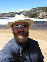
 Chuck's 800 Skidoo Summit, armed for two.
 Since the Avi danger was a bit iffy for bigger stuff on Togwotee, we decided the blue bird weather would be handy for exploring some new country. So we headed up north out of Dubois to see if we couldn't get a bead on some lines in the Ramshorn country- maybe even the peak. We parked near the where Horse Creek road turns to go up Double Cabin. Armed with just Chuck's powder hog and our splitboards we headed out. We buzzed past the T-Cross Ranch, dodged a moose, and just followed the snow machine tracks. I believe we ended up in the Ramshorn Basin area, which is not exactly where I wanted to go. We missed the turn that would take us towards Burrough's creek. Bugger. We would find it later though.
 Out of Ramshorn Basin we started skinning up a big nameless mountain (part of the "Ramshorn"). About 40 minutes into the skin things like this (above) started coming into view. Way cool, except- that's the stuff we wanted to be on. We kept climbing, and eventually our ridge line turned SE. The snow started to get crusty.
 One of several bowls that we got a look at- all part of the Ramshorn area. Someone's probably got names for them. I couldn't find any on my maps though.
 A very good looking couloir.
 Over a thousand feet later, out of the trees and on to the steep- looking East/ NE.
 Once out the trees the almost South facing snow was really cooked. Ski pole tests and probes revealed at least a 1-2 inch hard crust sitting on surface hoar. As steep and as big as the slopes were above us, we didn't think it was a good idea to continue up this mountain. Even if it held, it would have sucked to ride. If it went, it could be deadly. So we opted to bail and head back down our skin track. Rats! Could have gotten an awsome view of Five Pockets from on top. Oh well- guess we'll try again on another day.
 Chuck begins the ride down our skin track, happy he doesn't have to climb or ride the 800 ft of suncrust above him. After we got back to the sled, we decided to back track and look for a road that would get us closer to some better aspects.
 Chuck blasts back over his track to come get me, after blazing a few miles in the powder up a route that would get us closer to the Ramshorn Peak area.
 Turned out blazing trails through powder is almost as much work as climbing and skiing mountains. Nearly as much fun too! Ha!
 A view of the mountain we spent most of day climbing, only to be denied. Bummer- that's the way it goes though sometimes. I'm glad we played it safe.
 Chuck looks at some amazing possibilities.
 Finally, we ended up more where we were hoping too. This ridgeline would have been very accessible from the sled, and it looked to be full of potentailly nifty couloirs and bowls to ski. On the other side was another huge bowl, and Ramshorn Peak. Buggeroo! I really wish we could have punched in here first. I'm fairly certian we could have scored some epic turns if we would have gotten here earlier in the day. It was 3pm by the time we got this far. We didn't really have any time left. Oh well. Now we know. Guess it's all part of dialing an area in.

 Closer looks at a couple of couloirs that caught my eye.
 Soaking it up, already thinking about the next possible opportunity I'll have to get into this area, and actually score some turns.

I generated this map using an old 99' Delorme Topo program. I'm not sure how accurate the roads are on it, but I'm fairly certain I plotted our approximate routes correct. You may have to click on it to read it. The red route is where we went first. The Black route is our ski/ climb route. The blue route is where we went exploring with Chuck's sled and got much closer to where we wanted to be.

posted by Shad Hamilton at 8:49 AM
![]()

0 Comments:
Post a Comment
<< Home